Whenua Waiariki
Mar 27, 2020

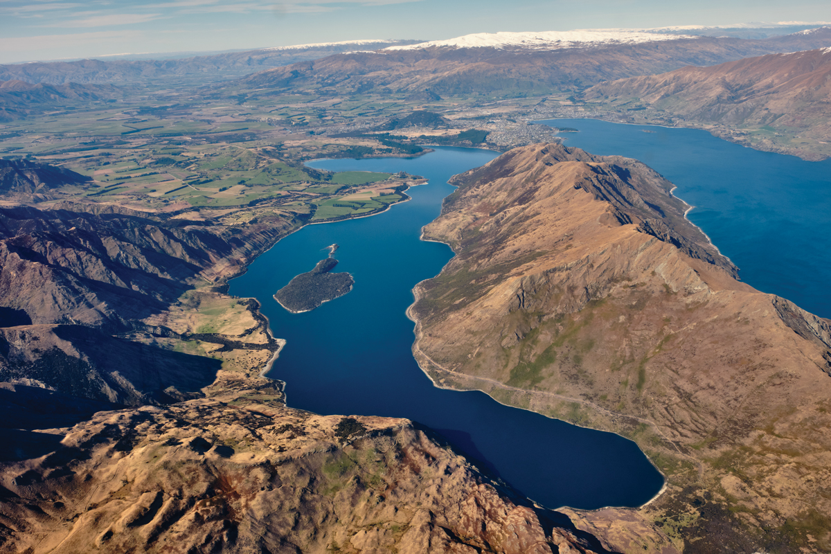
Waiariki (Stevenson’s Arm) is the picturesque stretch of water in Lake Wānaka between Parakārehu (Stevenson’s Peninsula) and the mainland. In 1844, the southern Ngāi Tahu leader Te Huruhuru drew Waiariki on a map for government agent Edward Shortland, who misinterpreted Waiariki as a separate lake. Pōkainamu and Te Pekakārara are traditional names for Stevenson’s Island, a small 65-hectare island located in the middle of Waiariki. The name Te Pekakārara was recorded by Te Huruhuru, and Pōkainamu is the name recorded by the well-known Ngāi Tahu leader Rāwiri Te Maire. In 2002 buff weka were first transferred from the Chatham Islands to Te Pekakārara/Pōkainamu to breed within a purpose-built predator-free enclosure. Prior to European settlement, weka were a major source of mahinga kai (food) in Central Otago with the feathers highly valued for clothing and hinu (oil) used to make paints and to preserve food.
Photograph: Tony Bridge/ Te Rūnanga o Ngāi Tahu Collection, Ngāi Tahu Archive, 2019-0660