Rereka ki te Toka
Jul 12, 2023

Nā Dr Regina Eisert rātou ko Dr Matiu Prebble, ko Dr Gerard O’Regan.
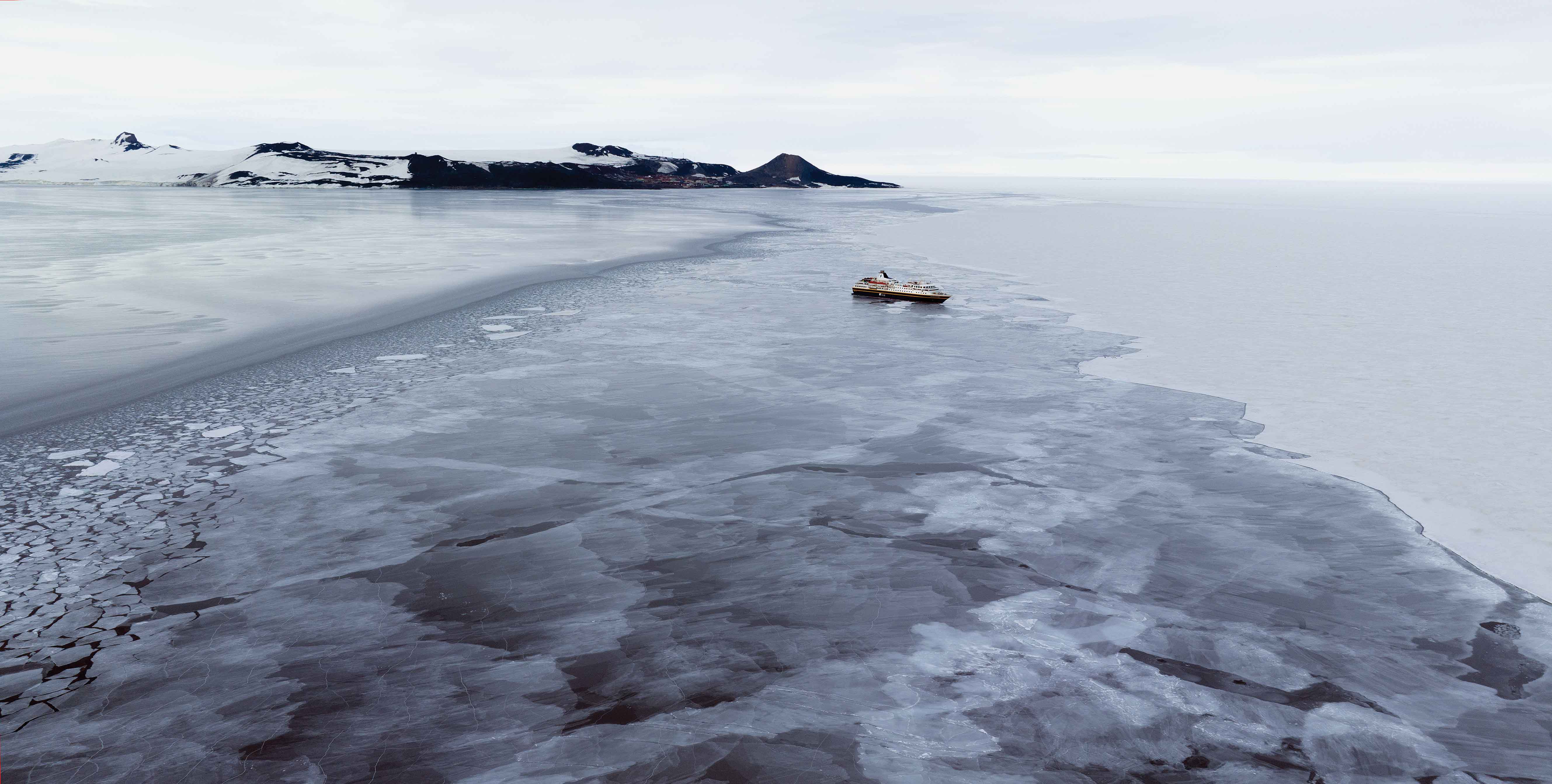
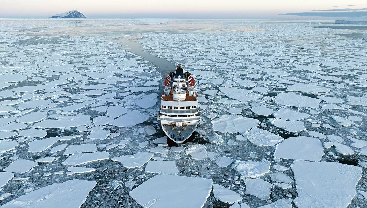
The Heritage Adventurer in front of Ross Island in McMurdo Sound, Antarctica. Photograph: Colin Aitchison.
Follow the birds
This past summer, three Ngāi Tahu expeditions followed the path of the birds and whales to the Southern Ocean, reigniting a long-standing interest in one of the most enigmatic regions of the world’s oceans. Gazing south, a vast expanse of water links Bluff to the great ice barriers guarding Te Tiri o Te Moana, the Antarctic Continent. On the way lie the Subantarctic Islands, cool and damp, sparse on top but with rich animal and plant life about the coastal edges and recognised as World Heritage Sites by UNESCO. These remote islands recall what Te Waipounamu might have looked like before humans first arrived. Pressing on, we arrive in the Ross Sea region. Seabirds and whales come here all the way from New Zealand, Australia, and as far as Tonga to feed under the midnight sun during the short polar summer, when the Southern Ocean teems with prey.
Explorers, Hunters and Scholars
The teams who travelled south followed the steps of early explorers. Ground-breaking work led by Ngāi Tahu archaeologist Atholl Anderson and Gerard O’Regan, in the late 1990s established Maukahuka – the Auckland Islands as the southern point of the Polynesian Triangle. About 700 years ago, Māori established camps on Enderby Island. Atholl found that they hunted seals and nesting seabirds and collected shellfish, but from his initial findings suggested that they did not stay long.
A few hundred years later, the promise of profit brought whaling ships from the Northern Hemisphere to hunt parāoa (sperm whales) and tohorā (baleen whales) all the way to Antarctica. When first visited by Pākehā, the sub-Antarctic Islands or in the Southern Ocean revealed no traces of Polynesian presence. On 24 January 1895, a Kāi Tahu man from Rakiura, William Timaru Joss, visited the Antarctic continent at Cape Adare as crew on the Norwegian Whaler Antarctic. This was one of the very first landings on the great southern continent and is considered the beginning of the “Heroic Era” of Antarctic exploration. One of their shipmates was world-famous explorer Carsten Borchgrevink, who four years later became the first human to overwinter in the Antarctic.
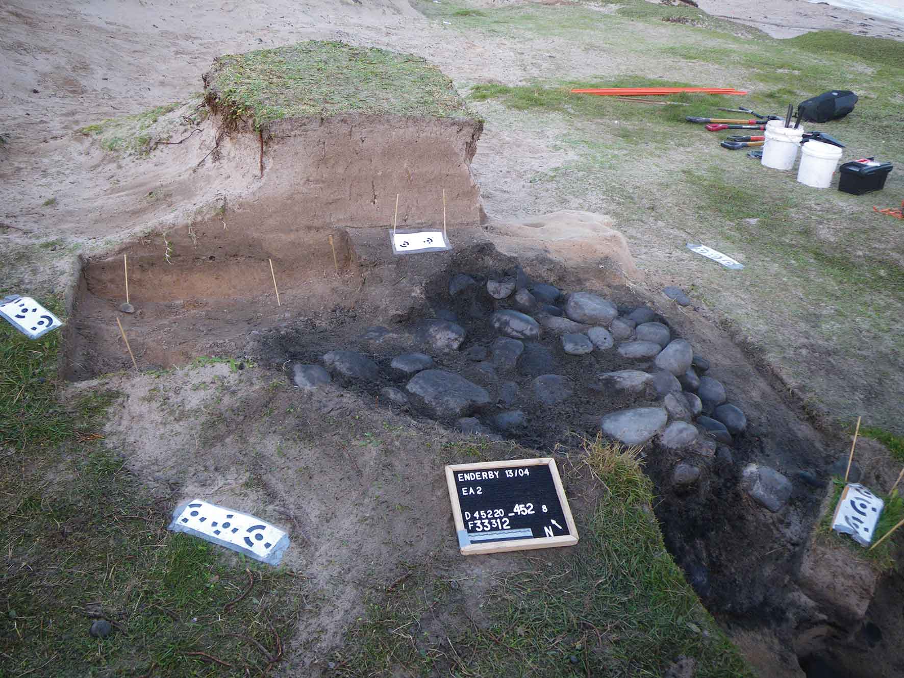
Te Umu Tawhito salvage excavation at Sandy Bay showing the marker points used for the 3D mapping of the positions of the hangi stones. Photograph: T. Ladefoged.
In April 2023, Kāi Tahu scholars Dr Matiu Prebble from the University of Canterbury (Kāi Tahu – Wairewa) and Dr Gerard O’Regan from Tūhura Otago Museum (Kāi Tahu – Moeraki) travelled to Enderby Island on board the yacht Evohe on a two-day crossing from Invercargill, leading a team to investigate how early Māori engaged in shaping the natural environment.
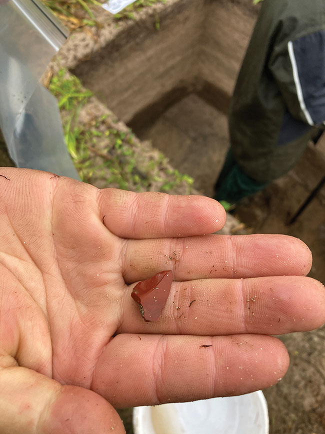
A red chert flake excavated from Sandy Bay, possibly from a source from Te Wai Pounamu. Photograph: T. Ladefoged.
Using the latest precision surveying equipment, they were able to map important archaeological sites in 3D. Excavations revealed more extensive occupation that was previously recognised and recovered the entirety of a large umu. “Normally archaeologists just count hāngī or umu rocks and then put them to the side,” says Gerard. “But this is the southern-most umu – earth oven – excavated in the whole of Polynesia so we decided to bring back every stone.
Otherwise, they would have eventually rolled down the beach due to coastal erosion and sea lion ‘trampling’. We had to decide what to do on the spot and, so, it was important have Murihiku rūnaka representatives Anthony Fowler and Rewi Davis there giving confidence to our thinking.”
Based in part from the expedition yacht Evohe, and in part from the DOC huts on Enderby Island, this two-week project has been the most extensive archaeological excavation undertaken so far on Maukahuka. Marie Dunn, currently an archaeology intern through Te Rūnanga o Ngāi Tahu, got to work with archaeologists, Professors Thegn Ladefoged and Simon Holdaway from the University of Auckland, world leaders in their fields, experiencing their approach to excavating and recording absolutely everything bigger than 2cm. Kāi Tahu project volunteer Teige Sherwood-O’Regan helped Matiu with collecting core samples to study the wider landscape.
“It is special to be doing this work down there, but it’s even more special when you see our next generation of kaimahi building their experience of the motu,” says Matiu.
The laboratory analyses on the recovered samples are continuing, with the help of Kāi Tahu intern, George Young, but already the results suggest that more extensive excavation is warranted. Matiu says, “From this project we’ll get some important insights into how our tīpuna interacted with local wildlife and made large scale as well as subtle environmental interventions that enabled them to possibly maintain an extended occupation, greater than previously thought. The evidence for re-use of stone and bone artefacts and clothing manufacture is critical to this picture.”
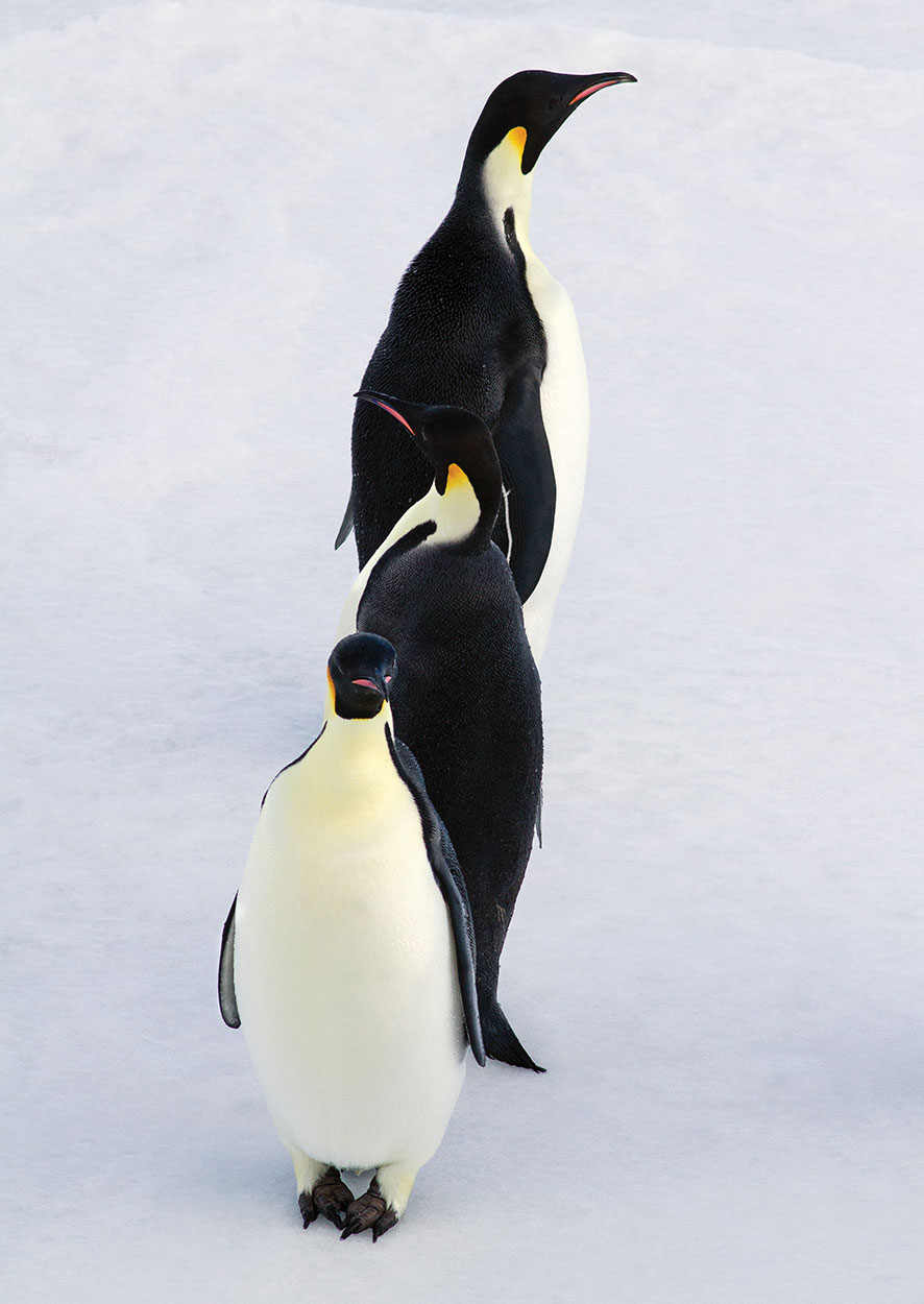
Emperor Penguins. Photograph: Dr Regina Eisert.
From our findings we can already work towards developing better strategies with DOC for protecting sites and artefacts from erosion and the encroachment of endangered rāpoka (New Zealand sea lions) that have found a refuge on the islands. “More importantly, we need to find ways of regularly returning to the island, allowing more Kāi Tahu to not only experience the wildlife, but also to understand the global importance of our cultural heritage.”
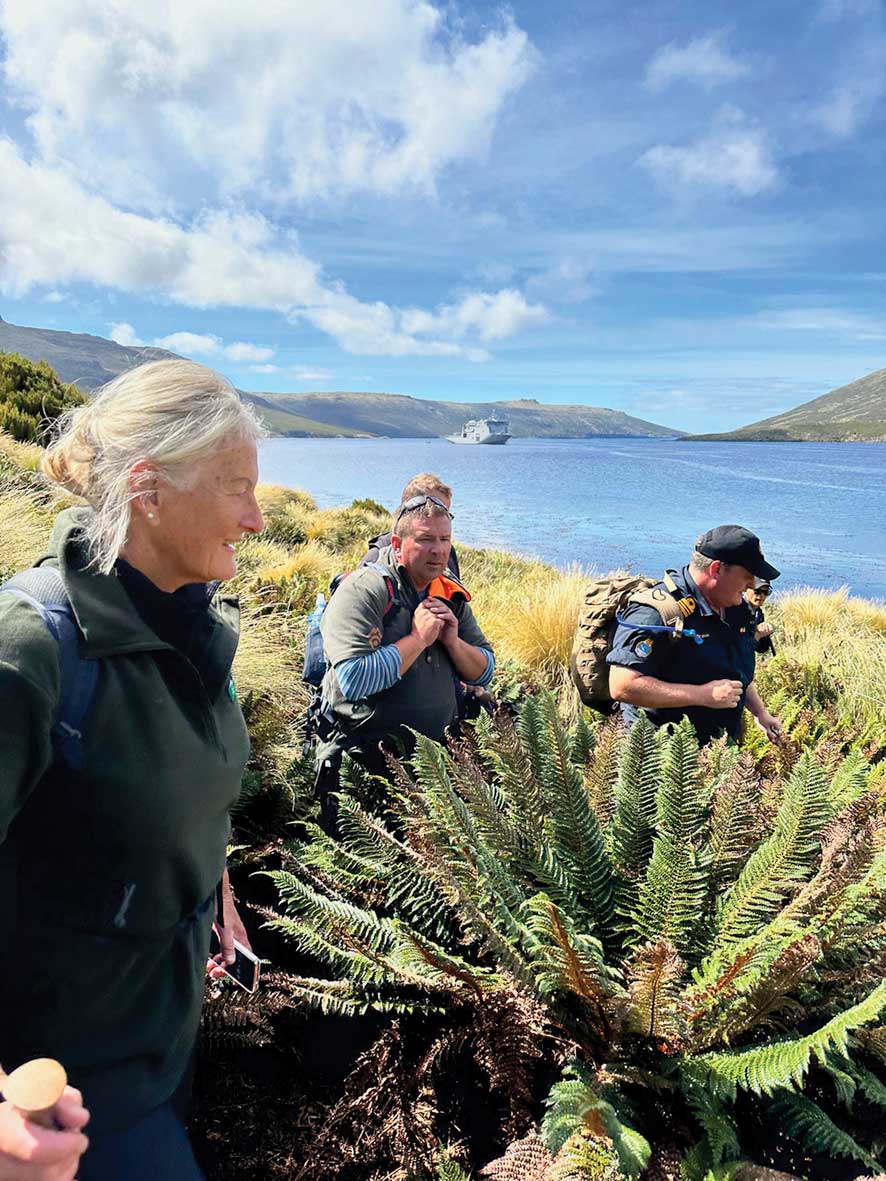
Te Rūnaka o Awarua whānau member, Bob Bowen, and his team, Vanessa Horwell (Te Anau) and Margaret Christiansen (Bluff), travelled south on a much larger
ship. Together with scientists, conservation staff, and 11 young people and five teachers sponsored by the Blake Foundation, he boarded the HMNZS Canterbury in Bluff to visit Moutere Ihupuku-Campbell Island that lies another 300km south-east of Maukahuka. Having joined the Navy straight out of school, Bob felt right at home onboard the ship.
The priorities for the Kāi Tahu team included supporting DOC and researchers visiting the island, as well as represent mana moana and mana whenua for Kāi Tahu. They helped unload gear and remove exotic weeds and completed preliminary monitoring of rāpoka, toroa (albatross), and penguins, of which there were at least six species on the island. But almost as soon as they arrived, disaster struck in the form of Cyclone Gabrielle, urgently calling the Navy away to help in the North Island and cutting short what was originally a 10-day trip. All the gear that had just been unloaded was loaded straight back onto the ship. Nevertheless, having seen the beauty of the region, Bob and his team are keen to find a way to return south.
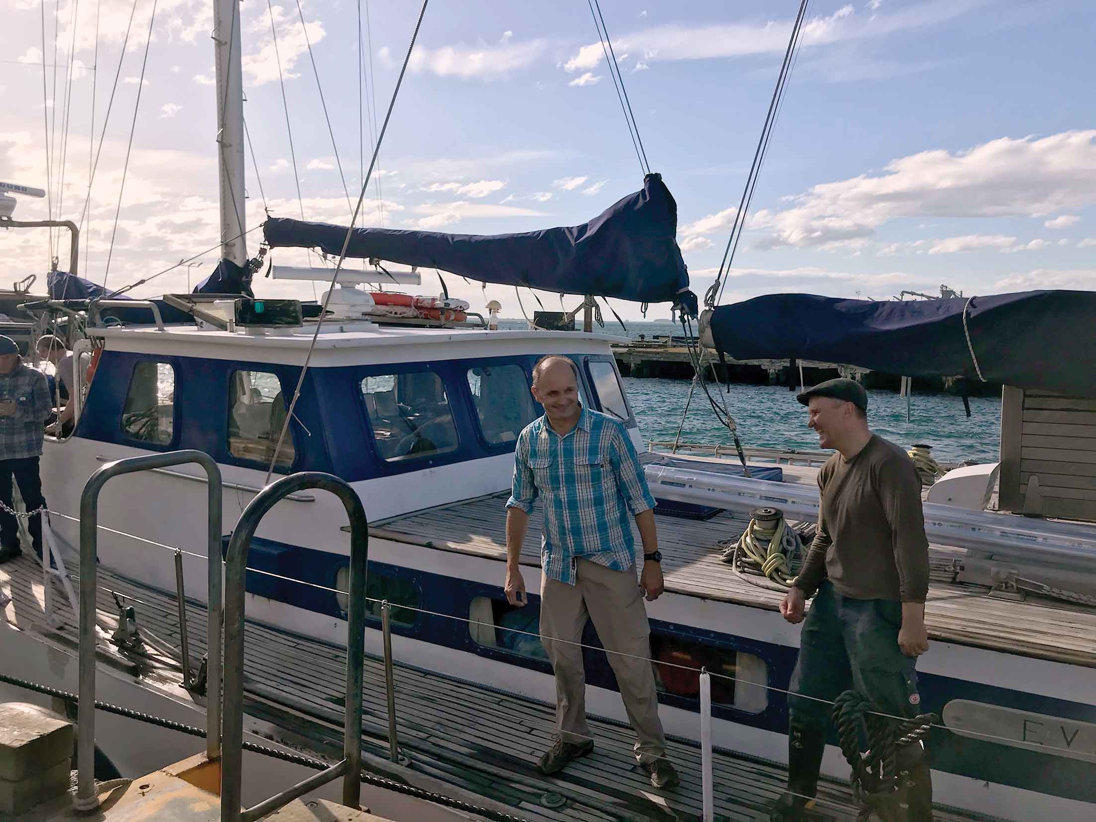
Dr Gerard O’Regan and Dr Matiu Prebble on board the Evohe before departure at Bluff. Photograph: A. Duks
Access to the Subantarctic Islands and the Ross Dependency has historically been difficult. While the New Zealand Defence Force is keen to partner with Kāi Tahu, their core duties override support of research and conservation.
The voyage to the Subantarctic Islands is a non-trivial undertaking in terms of cost and risk, and going to the Ross Sea, another 2,000 km south from Maukahuka across some of the roughest seas on the planet, is another challenge altogether. However, a new initiative led by Murihiku Regeneration aims to establish access for Ngāi Tahu and support kaitiakitaka and rangatirataka of the region.
The Heritage Adventurer heading south into the Ross Sea. Photograph: Colin Aitchison.
Murihiku ki Te Tonga – a new Research and Monitoring Programme
Murihiku Regeneration was established in 2020 by kā southern rūnaka of Kāi Tahu as a long-term inter-generational programme supporting social, economic, cultural, and environmental well-being. Recognising the close connection between Murihiku and Te Moana-tāpokopoko-a-Tāwhaki, it became clear that Murihiku Regeneration needed its own research and monitoring capability, including reliable access to the entire Ross Sea sector from Fiordland to Antarctica.
To this end, Murihiku Regeneration approached Christchurch-based company Heritage Expeditions, who have been running nature cruises in this part of the world for several decades. Both partners quickly realised the synergies created by combining scientific research and sustainable tourism, and the inaugural Murihiku ki Te Tonga research expedition to the Subantarctic and the Ross Sea left Bluff on board the stately MS Heritage Adventurer on 3 February this year.
The journey south had particular significance for the leader of the Murihiku team, Riki Nicholas (Ngāi Tahu, Tainui, Cook Island Māori), who comes from a long line of seafarers.
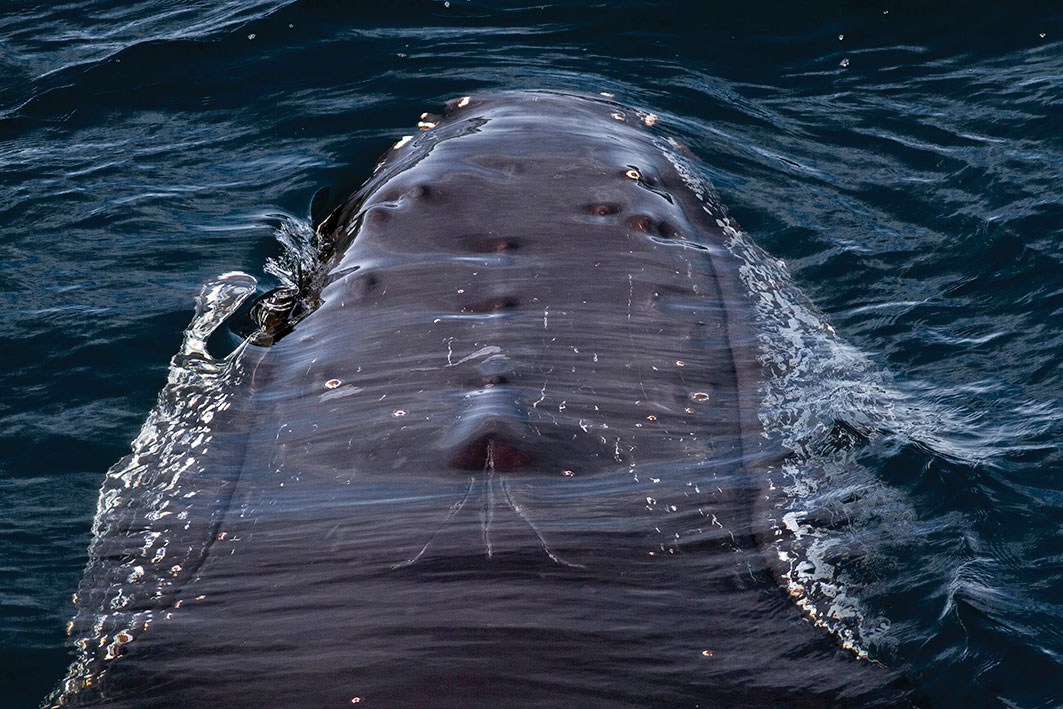
Paikea (humpback whale). Photograph Supplied: Dr Regina Eisert.
On this expedition, he is retracing voyages made by his relatives from Rakiura, William Timaru Joss and his brother Walter Douglas Joss, who helped rescue the survivors of the General Grant wrecked at Maukahuka in 1866.
From Bluff, the team made their way south, calling at Tini Heke/Snares Islands, Maukahuka, Macquarie Island, and towards the Balleny Islands south of the Antarctic Circle.
This forbidding archipelago just off the coast of Antarctica is one of the great hot spots for marine life in the Southern Ocean and part of the Ross Sea region Marine Protected Area (MPA). Right on cue, over a seamount just north of the Balleny Islands, the ship encountered paikea (humpback whales) that surrounded the ship, splashing and diving and showing their great black backs covered in barnacles.
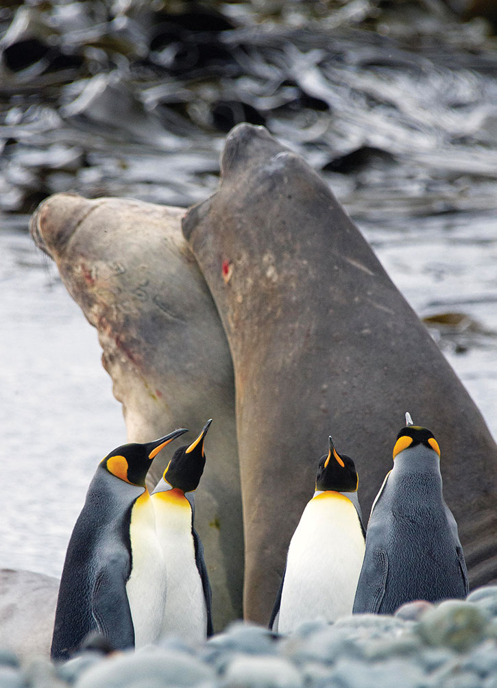
King penguins and juvenile ihi koropuku (elephant seals) at Macquarie Island. Photograph Colin Aitchison.
Two parāoa remained aloof and carried on feeding without paying heed to the ship. The big bull males may have come from the coasts of southern New Zealand to hunt in the Ross Sea.
The Murihiku team of Riki Nicholas, Regina Eisert and Colin Aitchinson, first landed on the coast of Antarctica proper at Cape Adare, the same place the first Kāi Tahu in Antarctica visited in 1895 and where Carsten Borchgrevink’s hut still stands. A desolate sandy spit dominated by steep cliffs, Cape Adare is home to Adélie penguins and the skuas and popoiangore (leopard seals) that hunt them. The wildlife, curious but undisturbed, watched their human manuhiri without fear.
Carrying on into the Ross Sea, the ship passes numerous icebergs. At this latitude, the sun no longer sets, and the team stays awake to admire the beauty of ocean, ice, and sky.
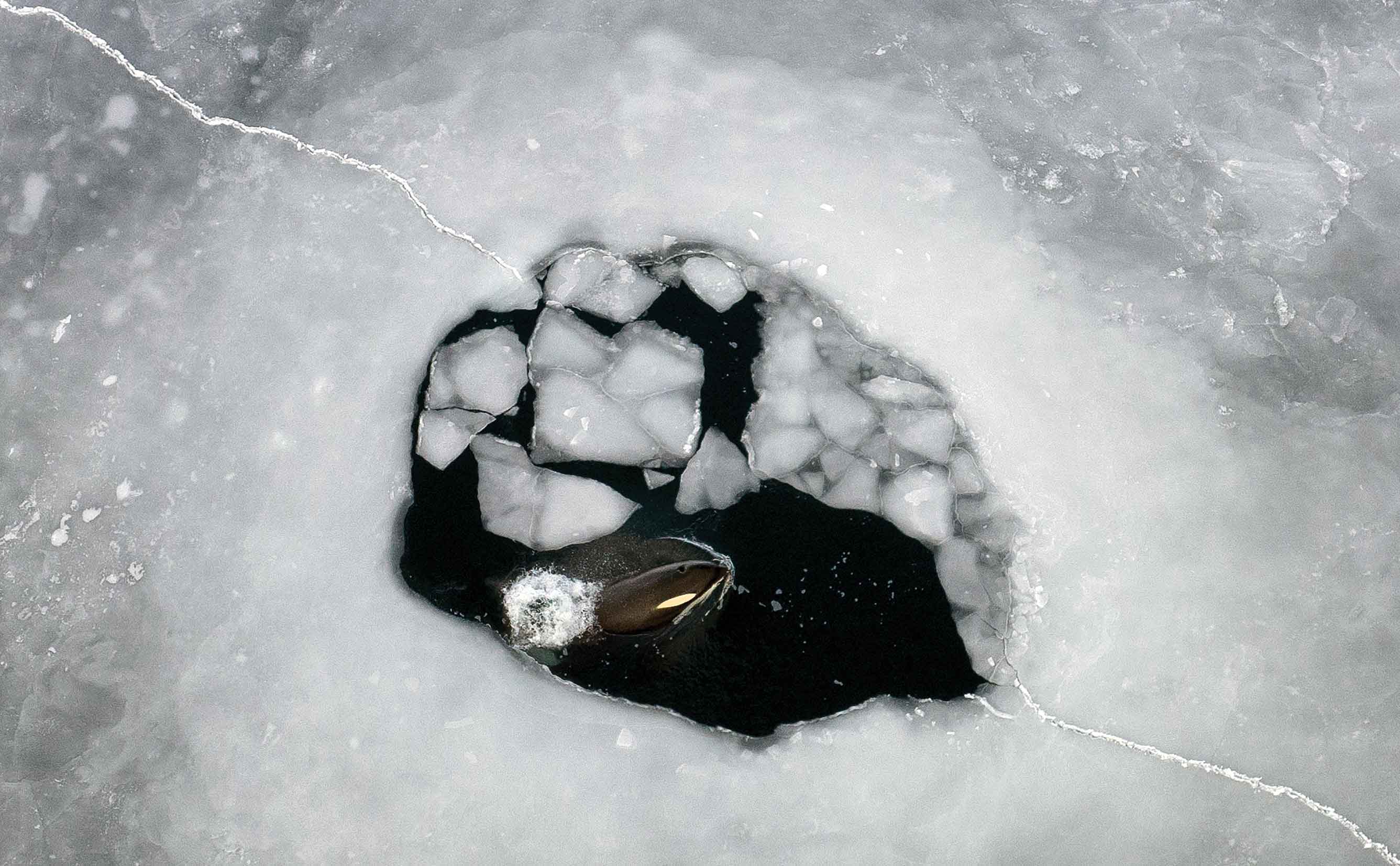
Killer whale in the sea ice. Photograph: Colin Aitchison.
At the furthest point south, just around the corner from Scott Base and its Pouwhenua, the ship parks up overnight at a sea ice berth surrounded by emperor penguins and killer whales that have come to inspect our strange object. At Hut Point, the team picks up their fourth member, veteran film-maker Anthony “Antz” Powell.
The team also kept an eye out for tītī, true to the motto, “Murihiku Tītī a Kāi, Tītī a Mānawa”. Tītī nesting in Murihiku takes long trips to sea to provision their young (up to two weeks) and fly as far as the
Southern Ocean. The team spotted large flocks of tītī in the Ross Sea region south of 60 deg S, emphasising the connection of Murihiku to the Southern Ocean and the Ross Sea region’s MPA.
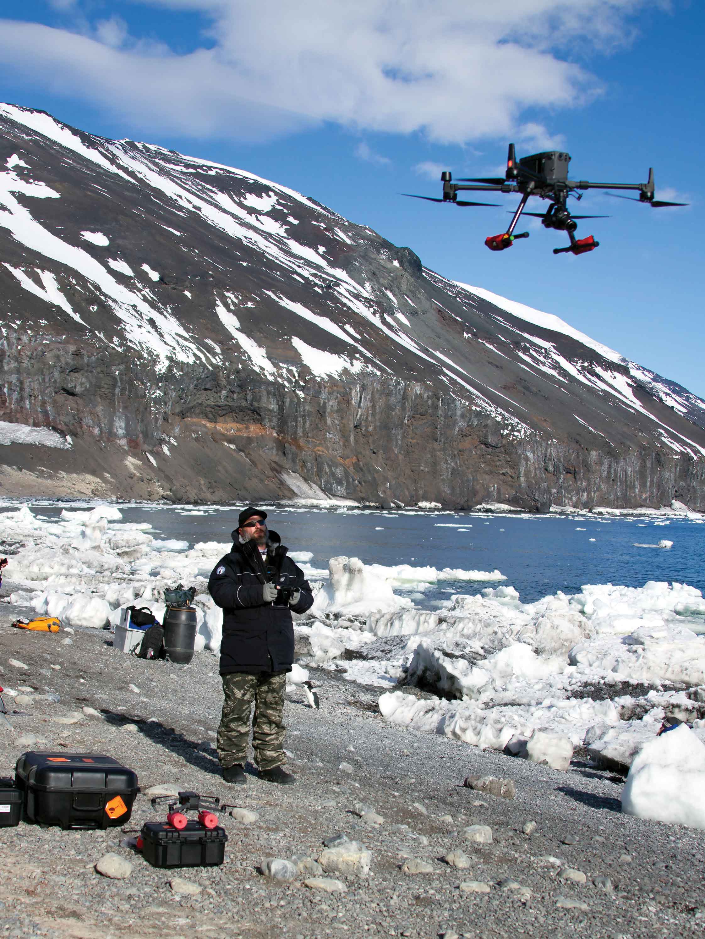
Colin Aitchison from the Murihiku team deploys a drone at Cape Adare. Photograph Supplied: Dr Regina Eisert.
As one of the scientific objectives of this expedition, the team deployed underwater and aerial drones to observe and record keystone species, including whales and seals. As high-level predators and mega consumers, marine mammals are powerful indicators of ecosystem status and monitoring them provides essential information about natural variations and potential change or disruption in things such as climate. The data and information collected on this first expedition provides the basis for developing effective research and monitoring of the region, and better understanding of the effects of fishing and climate change.
Kotahitaka – Partnership for Cultural Heritage and Biological Conservation
Margaret Christiansen, Bob Bowen and Lt Commander Kerry Driver on Moutere Ihupuku-Campbell Island. Photograph Supplied: Dr Regina Eisert.
It’s clear that what happens in the Ross Sea Sector south of Aotearoa has important consequences for the climate, productivity, marine resources, and wellbeing of Te Waipounamu.
Effective stewardship of the environment, cultural heritage, including historic sites, is only possible based on knowledge and reliable information. The growing Kāi Tahu interest in the Ross Sea Sector sets an important precedent for joint management of the region together with DOC. Key to these efforts are reliable access and logistics support for Kāi Tahu researchers, conservationists, students, and collaborators in the Ross Sea Sector.
As demonstrated by the inaugural Murihiku ki Te Toka expedition, fresh approaches such as the partnership with Heritage Expeditions provide a cost-effective solution. While tourism can be antithetical to conservation, the controlled, sustainable sharing of natural taoka can turn visitors into life-long ambassadors for conservation and stewardship.
However, it is essential that Kāi Tahu play an active role in managing the Ross Sea Sector to ensure decisions are evidence-based and aligned with Kāi Tahu values. As this last summer has shown, Kāi Tahu are once again following the birds and the whales, kā tapuwae o kā tīpuna – the footsteps of the ancestors to the Great Southern Ocean.
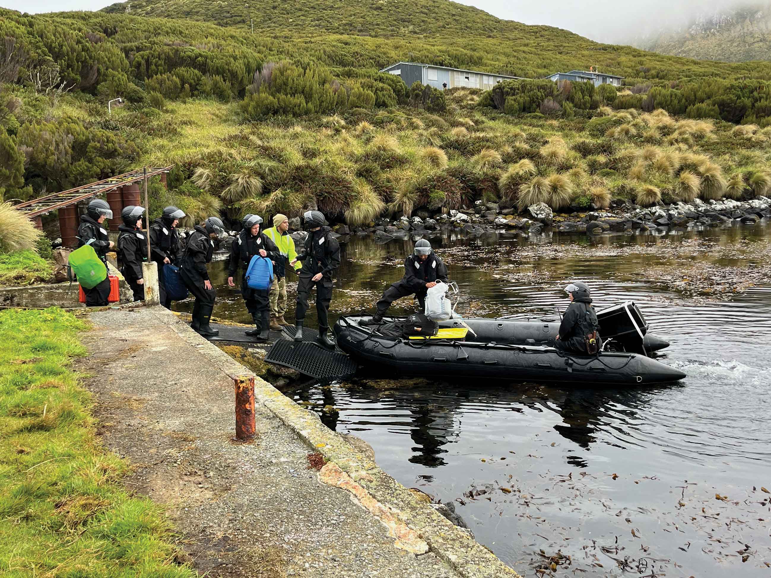
Loading up to return back to HMNZS Canterbury. Photograph Supplied: Dr Regina Eisert.