A view from the top
Oct 9, 2013

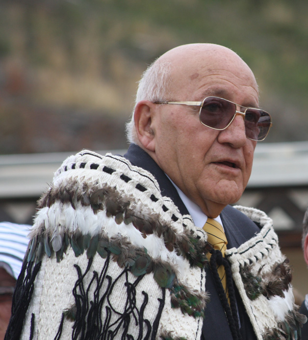 Tā Tipene O’Regan steps down after 28 years on the New Zealand Geographic Board and says attitudes have changed when it comes to place names. Kaituhituhi Mark Revington reports
On the wall of Tā Tipene O’Regan’s New Brighton house hangs a framed map of Antarctica given to him in recognition of his long contribution to the New Zealand Geographic Board, which ended this year. On it is a peak named after him, a singular honour saluting his 28 years on the board.
In that time New Zealand has changed. His tenure on the board coincided with a renaissance in Maoridom although he prefers to talk about place names themselves and their etymology or origin and development rather than cross reference his work with New Zealand’s relatively recent cultural shifts.
He will say there has been a marked shift in attitudes to place names in New Zealand which reflects our maturing as a nation.
 “Language continually evolves but some remains stuck. Putting names on maps fixes those names in time. From when I first joined the board there has been a massive change in attitudes. There have been two factors at work – a much greater willingness to name things which are distinctly New Zealand and secondly, a much more accommodating welcome to Māori names and Māori pronunciation in general. You only have to listen to the weather and the news. There are an increasing number of people around New Zealand who don’t carry linguistic baggage.”
Tā Tipene had spent 28 years on the board when he stepped down earlier this year, to be replaced by Te Maire Tau as the Ngā Tahu representative.
He was first appointed in 1985 by then Minister of Māori Affairs Koro Wetere and remained on the board while others came and went, amassing vast knowledge, not only of the board’s deliberations but of the importance of place names in New Zealand.
Place names in traditional Māori society played a much different role, as Tā Tipene points out. To many people these days they are often little more than sign posts on a journey. While plenty of Māori names do use a geographical description, place names in a society that depended on oral tradition would convey far more.
A book produced by the New Zealand Geographic Board and co-written written by Tā Tipene, calls them ‘Ngā Tohu Pūmahara – The Survey Pegs of the Past’. A paragraph in the book clearly states the case:
“The most important role of place names in a society in which traditions and history were transmitted orally was to serve as triggers for memory. They reminded those who spoke or heard them of events or episodes important in the history of the tribe. They were the means by which the tribe’s traditions and knowledge of its tūpuna were handed on. To understand a great number of New Zealand’s place names you need to know the tribal histories of the district in which the names occur.”
Names then have power and significance, Tā Tipene says, a point that has not always been understood by Pakeha. Ultimately they are about identity and connectivity, sign posts to the past, recording the stories of the people who lived there, what they did and where they came from.
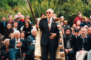
At the hakari at Pipitea Marae following the passing of the Ngāi Tahu Claims Settlement Act 1998.
Take a drive with Tā Tipene and his passion for place names soon becomes obvious. Every place has a name, and every name has a story. They roll off his tongue with remarkable fluency.
It perhaps helps explain why he committed so many years to the New Zealand Geographic Board when sometimes, as he says, he was “pretty lonely at times in cultural terms”.
What’s in a name and why has there sometimes been so much resistance to changing a name on the map of New Zealand? People are naturally resistant to change, says Tā Tipene.
Māori covered New Zealand in names. Some referred to distinctive geographic outlines. Others spoke of tūpuna and stories which referred to the history of a hapū or tribe, generally a memory held by a group, rather than an individual.
Still others came here on the waka of the first Māori settlers just as in later centuries, Pākehā explorers, missionaries and settlers imported names familiar to them.
Complicating matters in New Zealand was the way early Pākehā approached the spelling of Māori names. “There is a huge challenge provided by the Māori experience when places began to be named on maps and names started to be written down,” says Tā Tipene.
“Rawiri Te Maire tells the surveyor the name of the lake we know today as Wānaka. The surveyor hears him say Wānaka the old Kāi Tahu way which used a ‘wh’. The surveyor wrote down Oanaka meticulously on a map.
“The river through Ashburton was pronounced as Whakatere. Akaroa was Whakaroa. Otago is is what they thought they heard Māori say. This wasn’t a symbol of nasty racism or ‘whaler Māori’ as some scholars have said. It was the way people wrote down what they thought they heard. Cook wrote Te Vaipoenamu on his charts because he is used to Tahitian words and hears a ‘w’ and is used to it being pronounced as a ‘v’. So with a lot of our Māori words, there is a question of orthographic evolution. The Kāi Tahu ‘k’ for instance is a southern phenomenon.
“Other instances are just plain mistakes. Take Manapouri for instance. All the signs will tell you it was originally called Moturau. Manapouri refers to one bay and was transcribed incorrectly in a cartographer’s office in Wellington but after the Save Manapouri campaign in the 1970s it was almost impossible tio change back. And it wasn’t a fight Ngāi Tahu were looking for.”
The New Zealand Geographic Board Ngā Pou Taunaha o Aotearoa to give the board its full name, “assigns, approves, alters or discontinues the use of names for geographic features , undersea features and Crown protected areas in New Zealand, its offshore islands and its continental shelf and the Ross Sea region of Antarctica”.
The board has nine members, nominated or recommended by the Minister of Māori Affairs, the Minister for Land Information, Local Government New Zealand. The New Zealand Geographical Society, Federated Mountain Clubs and Te Rūnanga o Ngāi Tahu who are appointed or reappointed in three-year periods. Ngāi Tahu has a permanent seat on the board, enshrined under the Ngāi Tahu Claim Settlement Act. The board is required under the Treaty of Waitangi to have a responsibility to tangata whenua and has a comprehensive list of guidelines regarding dialogue with Māori and consideration of Māori names, a legacy Tā Tipene is particularly proud of.
“The Māori members on the board have to deal with a whole number of non-Māori questions and it could get pretty lonely at times in cultural terms. Even though you are a member of the board and have a particular interest in the South Island, that is a minor part of the total work of the board.
“I had the great privilege to work with Professor Wharehuia Milroy and also for a shorter time with Apirana Mahuika. In 1990 Ngāi Tahu asked the then Surveyor General Bill Robinson (Murihiku Kai Tahu) to hire Te Auē Davis of Maniapoto to drive publication on Māori names. That was how Ngā Tohu Pūmahara – The Survey Pegs of The Past came about, At the same time the Board published the Maori Oral History Atlas and the Maps of Maori Place Names which adorn so many of our marae. These were all edited by Te Auē and illustrated by Cliff Whiting,” Ta Tipene says. “They were all put together on Bill Robertson’s watch – it helped to shift the whole climate.
“Wharehuia and I were able to work with Te Auē post-1990 to develop an inventory of Maori geographic descriptors. It is quite important to understand that a lot of Māori names are actually geographical terms – or descriptors. For example rae is the word for forehead or brow. It is also a word for a particular shape of cliff. And then you get all sorts of different words that go to describe different types of cliffs or hills or peaks. But what is the distinction between peak and a mauka and how did our old people categorise these things?
“There are all these descriptors for rocks, different kinds of water and the shapes of hills. They are all part and parcel of place names in Māori. It is quite complex and we did a lot of work on that which is available online on the board’s website. It was a huge job.”
As more Treaty of Waitangi settlements were passed, iwi called for names important to them to be included in settlements. Ngāi Tahu ensured changes to 88 place names, helping restore its connection to the landscape of Te Waipounamu. But this produced yet more complexities in ensuring names were correct. It has meant a major body of work for Tā Tipene and others.
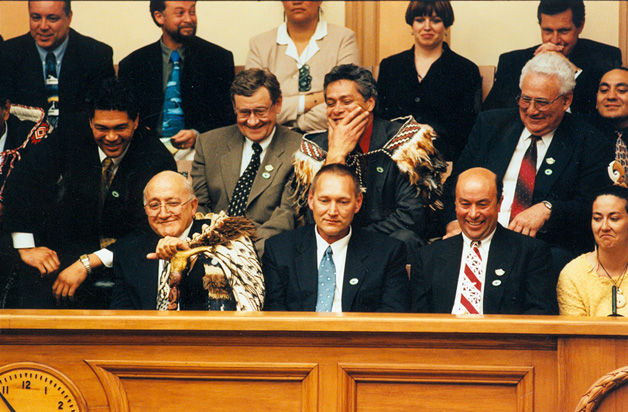
At the passing of the Ngāi Tahu Claims Settlement Act 1998.
“Ngāi Tahu had this big list of place names and there were mistakes made in the attached notes which became part of the schedule of the Settlement Act. When we realised, we also realised that these and other corrections could only be made by an Act of Parliament. Ngāi Tahu had created a huge problem both for itself and for the Geographic Board which then became snowed under as demand grew all over the country for place names in settlements. It’s taken quite a time to sort out a working process that overcomes the problem of entombing errors in legislation.
“It led to huge pressure on staff and we often had to explain to Pākehā colleagues what was going on. Quite often we would get Te Auē to come out of retirement or get Wharehuia to talk to applicants. They generally got things sorted. We engaged in a lot of negotiation with iwi and had some great scholars on board apart from Wharehuia Milroy.
“Dame Evelyn Stokes was one. She was a University of Waikato geographer and a Fellow of the Royal Society, highly recognised for her geographic scholarship and a great supporter. The intellectual clout that Maori were able to bring to bear had real firepower.”
In recent years he has chaired a Māori names committee and been a member of the undersea features committee. He has been invited to speak to the International Hydrographic Society three times, and delivered a major paper to the World Shallow Survey Conference essentially about the history of hydrography – one of his personal passions.
Tā Tipene speaks of the new challenges facing the board, and Māori, in naming undersea features, the continental shelf and the Ross Sea region of Antarctica.
“There are some big issues ahead in Māori names if you follow the principle that where New Zealand goes, the Treaty of Waitangi goes. There is the expansion of the continental shelf and New Zealand naming rights in Antarctica…”
It is a long way from those early years. Tā Tipene says his appointment to the board was made easier by the presence of Koro Wetere as Minister of Maori Affairs, who was hugely supportive. “And frequently the things we talked about were shared with Tainui and Tuwharetoa. We shared a triangular relationship which ensured we got attention.”
Despite the odd debate and the workload, it is obvious he has a huge passion for the work. But it is time to pass on the responsibility, he says.
“I love the work. The only reason I wanted to retire was to ensure a strong succession process. I wanted to be around to support my successor and be available for some of the more difficult stuff.
THE NEW ZEALAND GEOGRAPHIC BOARD
The New Zealand Geographic Board Ngā Pou Taunaha o Aotearoa (NZGB) is an independent statutory body responsible to the Minister for Land Information, operating under The New Zealand Geographic Board (Ngā Pou Taunaha o Aotearoa) Act 2008.
The Surveyor-General (a statutory officer within LINZ) is chairperson (ex-officio) of the New Zealand Geographic Board Ngā Pou Taunaha o Aotearoa (NZGB), which comprises nine other members appointed under the New Zealand Geographic Board (Ngā Pou Taunaha o Aotearoa) Act 2008.
The NZGB secretariat is located within LINZ and provides the NZGB with administrative support, research assistance and advice. Members are nominated or recommended by the Federated Mountain Clubs, New Zealand Geographical Society, Te Rūnanga o Ngāi Tahu, Minister of Māori Affairs, Minister for Land Information and Local Government New Zealand.
Principal functions of the board are to assign official names, to approve recorded names (unofficial names that have appeared in at least two publicly available authoritative publications or databases), to alter official or recorded names (by substituting a new name or correcting its spelling), to discontinue the use of official or recorded names, to investigate and determine the position and extent of a feature whose name is assigned, approved or altered and to review Crown Protected Area name proposals.
These functions can be exercised in relation to the following features within the NZGB jurisdiction: geographic features and places, undersea features, Antarctic features, Crown Protected Areas such as national parks, reserves and so on, treaty of Waitangi settlement names and foreshore and seabed recognition instrument names.
The board’s jurisdiction covers the territorial boundaries of New Zealand (12 nautical miles off the coast); offshore islands including the Kermadec, Chatham, Auckland, Antipodes, Campbell, Snares, and Bounty Islands, the continental shelf of New Zealand and the Ross Dependency of Antarctica (including its continental shelf).
addition to its principal functions, the NZGB may also adopt policies, rules and standards to assist it in carrying out its functions for the spelling and systematic designation of official names, to examine cases of doubtful spelling and determine official spelling appearing on maps and charts, to investigate and determine the priority of discovery of a feature, to collect original Māori names for recording on maps and charts, encourage the use of original Māori names on maps and charts, and to seek advice from Te Taura Whiri I te Reo Māori (Māori Language Commission) on correct orthography of Māori names.
.